Drone Surveys in Lismore
Get a FREE Quote in Lismore
Thank you for contacting Environment Restoration Solutions.
We will get back to you as soon as possible.
Oops, there was an error sending your message.
Please try again later.
Environmental care & practical earthworks solutions.
Clear Aerial Insights for Sites
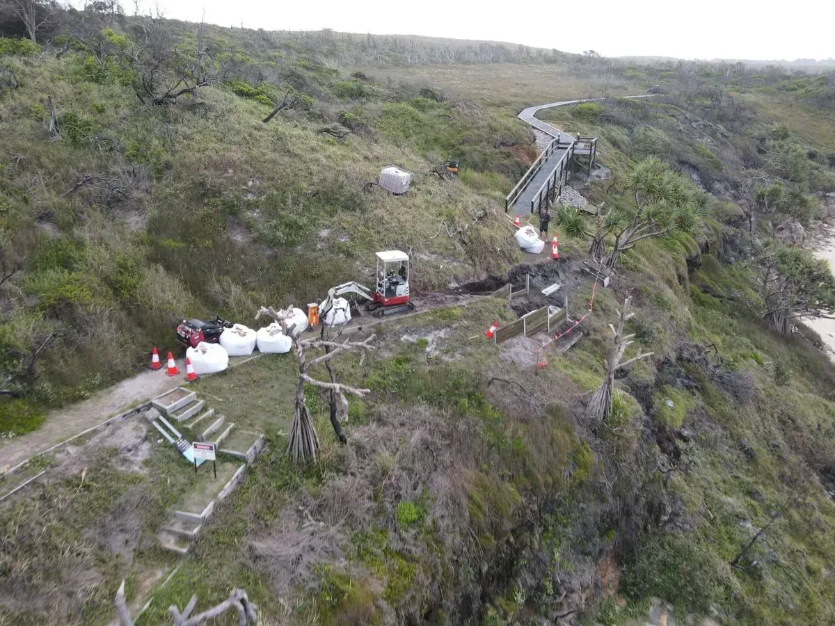
Planning work on a large or uneven site can be difficult when you cannot clearly see how the land behaves from above. That is where drone surveys in Lismore can make a real difference. Using aerial technology, we capture detailed imagery that helps construction teams, councils and landowners better understand their site before work begins. This aerial perspective reveals terrain changes, drainage paths and vegetation coverage that may not be obvious during ground inspections. Accurate information helps projects avoid surprises and move forward with clearer planning.
Our team at Environment Restoration Solutions works across the Lismore region, providing reliable survey data that supports site preparation and environmental work. We use practical experience alongside drone technology to deliver useful insights for projects of all sizes. Local contractors value aerial surveys because they make it easier to visualise the site and identify potential challenges early. Drone surveys can also support monitoring of erosion or restoration progress over time.
If you need dependable drone surveys in Lismore, call 0400 525 426 to discuss your project.
Frequently Asked Questions
What differences exist between traditional land surveys and drone surveys?
Traditional land surveys rely on ground-based equipment such as total stations and GPS receivers to measure specific points across a site. Surveyors physically move around the property to record distances, elevations and boundaries. Drone surveys, on the other hand, capture aerial imagery that is later processed into detailed maps and models. This allows large areas to be documented quickly while providing a visual overview of the terrain. While traditional methods remain important for precise boundary work, drone surveys are often used to complement them by adding broad site visibility and terrain data.
What site conditions can affect the quality of a drone survey?
Several site conditions can influence the clarity and accuracy of drone survey data. Dense vegetation can hide ground features, making it harder to capture the terrain beneath tree cover. Strong winds may affect flight stability and image quality, particularly on large or exposed sites. Lighting conditions also play a role, as harsh shadows or very low light can reduce image clarity. Highly reflective surfaces such as water can sometimes distort captured imagery. For the best results, surveys are typically planned when weather and lighting conditions allow consistent and stable image capture.
What types of information can a drone survey reveal about a site?
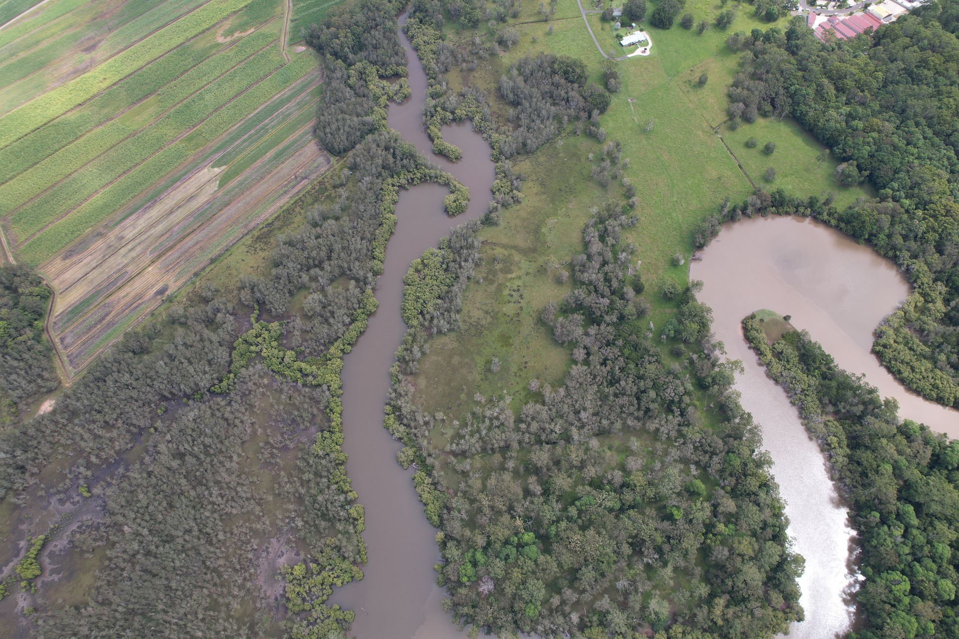
Drone surveys can provide a wide range of information about the physical characteristics of a site. Aerial imagery can show terrain shape, elevation changes and the layout of natural features such as vegetation and drainage paths. This information helps planners understand how water may move across the land and where erosion risks could occur. Drone data can also reveal site access routes, disturbed ground areas and overall land coverage. These insights support planning decisions for construction, environmental management and land restoration projects.
Aerial Mapping for Land Assessment
Many sites around Lismore include uneven terrain, vegetation cover or drainage features that can influence how construction or restoration work should proceed. Drone surveys provide a practical way to capture this information quickly and safely. High-resolution imagery collected from above allows project teams to review land conditions in detail and make informed planning decisions. The aerial data can assist with identifying erosion risks, mapping ground contours and assessing access across the site. These insights are especially useful for environmental restoration or earthworks planning where understanding the landscape is essential.
Our surveys are carried out carefully to ensure the information gathered is clear and useful for the project. Clients across Lismore often use drone imagery to monitor site progress and document land changes over time. Having accurate aerial data available makes it easier to manage both environmental responsibilities and construction planning. Drone surveys provide a reliable foundation for smarter land management decisions.